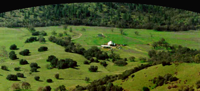
El Dorado County covers 1,095,350 acres (1,805 square miles) of the Sierra Nevada foothills and alpine peaks,
stretching 90 miles from Sacramento to Lake Tahoe. Over half of the county is publicly owned (parks, recreation areas, and national forests), and there are private timberlands, parks, campgrounds, and other recreation areas.
Elevations range from 200 feet near El Dorado Hills in the west to over 10,000 feet near Lake Tahoe. Climate varies with the elevation—from hot, dry summers and moderate winters in El Dorado Hills and Placerville, to slightly cooler summers and snowy winters Pollock Pines to South Lake Tahoe. 
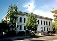
Within the county boundaries, two small incorporated cities thrive, Placerville and South Lake Tahoe. Placerville, 45 miles east of California's State Capitol in Sacramento, is the El Dorado County seat. It survived the abandonment that abruptly ended so many Gold Rush camps, mainly because of its popular location. This history-drenched town is found about
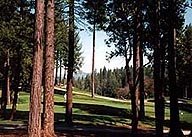
Apple Mountain Golf Resort
|
half way between Lake Tahoe and Sacramento along US 50, the road that was and continues to be an important route over the Sierras.
At the eastern-most end of the County, the Nevada border, glistens the city of South Lake Tahoe on the shore of the nation's second deepest natural lake. Ninety miles from Sacramento via US 50, South Lake Tahoe is world renown for its beauty and year-round recreation, which includes skiing, boating, sightseeing, camping, hiking, and fishing.
The county has two main thoroughfares. US Hwy. 50 runs basically west-east; SR 49, north-south. SR 49 crosses US 50 in Placerville at Spring Street. I-80 can be reached at Auburn, about 25 minutes north of Placerville on SR 49. I-80 and I-5 can be reached in Sacramento, about 20 minutes west of El Dorado Hills via US 50.
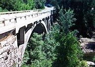
Old bridge over the Cosumnes |
SR 49, which meanders along the Sierra Nevada foothills, is the Mother Lode Highway of '49 Gold Rush fame.
El Dorado County's northern California location makes it convenient to other popular west coast destinations, a day's drive or less to either San Francisco, Los Angeles, Sacramento, Reno, Yosemite, Mt. Shasta, and the Mendocino Coast.
Over 78 percent of the county's residents live in unincorporated areas outside of city limits. Major residential communities (El Dorado Hills, Cameron Park and Shingle Springs) in the western part of the county serve as suburban areas to the booming Sacramento metropolitan region.